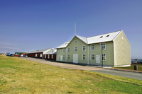
When in Keflavík in the municipality Reykjanesbær, a walk down Hafnargata, the main street , will bring you into contact with a number of things do to and see. In addition to conveniently-located stores and some interesting handicraft shops, at the north end of the street there is a fascinating museum of Bátasafn Gríms featuring models of ships and boats crafted by a local sea-captain. There is also an enlightening exhibition looking back at the 50-year history of the NATO base that closed in 2006.
At the Gróf Marina, you can learn about the giantess who inhabits the cave nearby - and it’s a great spot to branch off into nature. From the small boat harbor at Gróf, a track leads past strange rock formations along the coast to the cliffs at Bergið where the Night of Lights festival draws many people in early September. From the cliffs you have a clear view over the peninsula and across the bay towards Reykjavík. Starting at the Marina, another track, a paved 10-km trail that allows you to bike or even hike or walk along the shoreline breathing in the fresh ocean air.
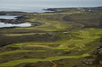
By car you can drive north out of Reykjanesbær to the golf course to enjoy some refreshments – or to play some golf. A recent article in Golf Weekly magazine compared this course to Pebble Beach in California!
With a 4WD it is also possible to follow old trails to the shore to enjoy the rich displays nature provides along the coast. As you approach the fishing village of Garður, there are old trails that lead to fish racks still used to dry fish. Entering the village, you will notice a monument dedicated to the families of fishermen. It depicts women looking out to sea waiting for their husbands to return with the day’s catch.
Garður has a beautiful, old church that dates from 1863 and next to it the former pastor’s home which is being restored. The building will serve as educational centre for pastors and as an information center about the many fascinating churches in Iceland. A trail beside the church leads down to the shore where you are in close touch with sea birds in their natural habitat. Grocery store, fast food and gasoline/petrol station, a bank and post office is here.
 The headland at the tip of the peninsula at Garðskagi is a great place to observe sea birds. There are two lighthouses where you can get great sea views too. A museum has a unique collection of old machinery and a cafeteria with a deck that lets you observe seals and whales that sometimes are play near the coast while you have refreshments. There is a local handicraft for sale in the old lighthouse guard´s home and a tranquil free campsite with toilets and fresh water.
Five minutes drive south on the west coast is the busy fishing harbor of Sandgerði which has an Icelandic Nature Centre with a small aquarium and a handicraft store. There is a display about the French explorer and biologist, Jean-Baptiste Charcout, who went down with his ship the Pourquoi Pas? off the coast in 1936. The village has a well equipped campsite.
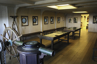
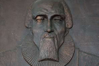
Heading further south, you will pass an eider duck farm. Another bird shares the farm, the small but very aggressive arctic tern which keeps away all trespassers. Here further on, will see an exceptionally beautiful church at Hvalsnes built of carved stone in 1887. The nation´s greatest psalm poet, Hallgrímur Pétursson served as a clergyman here in the mid 17th century. There is also a lighthouse on the rocky coast at Stafnes. This is the region where an important fishing port thrived at Básendar during the 17th and 18th centuries until the town was literally blown away by a violent sea storm in 1799.
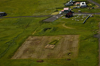
At this point, a road that used to be part of the NATO base leads to what is now the tranquil old fishing village of Hafnir. Because the fishing banks were close to shore, the village was a magnet for fishermen on the southwest coast before the spread of engine-equipped boats. Indeed, this is the site of recent archeological excavations that have uncovered ruins dating from the early years of settlement in the 9th century. It is here also that an American cargo
ship the Jamestown mysteriously ran aground in 1881 - with its cargo intact but no sign of its crew! The ship’s anchor can still be seen here.
As you continue past some desolate farms, you first pass the farm Merkines, the home of the brother/sister singing team, Ellý and Vilhjálmur, who sang their way into the hearts of Icelanders through their very popular LPs. You will then see a fish farm which has stations in other parts of the country, producing salmon roe and smoked filets sold all over the world. Across the road, a cairn marks the start of an old hiking or walking path called Pastor’s Trail that leads through lava fields and grasslands to Grindavík. The hike or walk over this varied landscape takes four to five hours.
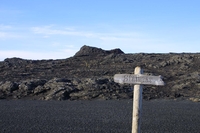
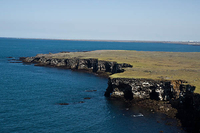
A car park further south is at the beginning of a 40-minute hike or walk to the coastal cliff Hafnaberg – a site teaming with seabirds such as guillemot, razor bill, fulmar, kittiwake, puffin and gannet. CAUTION: The cliffs are crumbly volcanic tuff. Stay away from the edge!
A turnoff to the left takes you to an interesting site: the Bridge between Continents. It marks a fissure that opened thousands of years ago and shows how Iceland is drifting apart at the rate of 2 cm per year average, towards Europe and N-America. If you cross the bridge, you can apply for a certificate at the Tourist Information Office in Reykjanebaer.
At this point the landscape is formed of really rough lava that came from eruptions of a 7 km long series of volcanoes, Stampar, in the 13th century. From the car park, a trail leads to the top of the main volcano giving a spectacular view over the surrounding area!
At the toe of the peninsula at Reykjanestá, there is an interesting geothermal area. A power plant harnessing the energy has an exhibition “Power Plant Earth” open every afternoon. The nearby boiling mud spring, named for the female ghost Gunna, can shoot up jets of boiling mud – so use caution. Gunnuhver is the biggest active hot mud spring in Iceland. There is good access for the disabled.
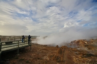
At Valabjargajá on the coast, you can view the only place on earth where the mid-Atlantic ridge stretching along the seabed all the way south to South Africa meets land. The fault line can be seen in the cliffs on the left-hand side of the road. A pond next by it provides a great spectacle of water rushing in or out with the tide. The fissure on the side of the pond is where children from Grindavík learned to swim the nineteen thirties and forties.

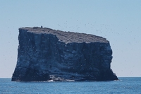
At the top of the cliff, the first lighthouse built in Iceland in 1878, which was replaced after an earthquake in 1907 on another hill, the one we see today. From there you can see the small (0.03 km2) island of Eldey which is 14 km off the coast and is home to one of the largest gannet colonies in the world.
By the coast driving east over the rough lava of lunar landscape reminds us of the fact that the austernauts that made the long journey to the moon were in Iceland to practice, one can understand that when here.
Along the road to Grindavík are two fish farming operations: Íslandsbleikja for arctic char and Hafrannsóknarstofnun a marine research institute. The cemetery of Grindavík is located here. There is a memorial to the person instrumental in setting up the Accident Prevention Association of Iceland, Rev. Oddur V. Gislason. There is also a golf course, Golfklúbbur Grindavíkur in the vicinity.
Sites around Grindavík include a fantastic example of forces shaping the landscape. Mount Þorbjörn displays a great crack (sigdalur) caused by a powerful earthquake thousands of
years ago. A road built when the mountain was a British base during WW2 provides an easy climb to the top. At the spring equinox, celebrants hike or walk up the grassy slopes to light a bonfire on the mountaintop before descending to bathe in the nearby Blue Lagoon in the midnight sun.

One of the most visited places in Iceland and one of the top spas in the world, the Blue Lagoon is renowned for the beneficial effects it brings to one’s skin, body and soul. Modern locker rooms, sauna, steam baths, and massage are available at the site, and you can visit the bistro, souvenir shop with the special Blue lagoon skin care line or the Lava Restaurant.

In addition to being a 5-minute drive from the Blue Lagoon, Grindavík is the second largest fishing port in Iceland and boasts an interesting Saltfish Museum. A good modern campsite, a swimming pool, restaurants and B&Bs are found in the town. Guided volcano tours in ATV 4WD jeeps are available, as well as bicycle tours and horseback riding. 
If you drive east towards the coast from Grindavík to Reykjanesfólkvangur National Park, you will be rewarded with a fascinating lunar landscape surrounding the spectacular hot mud springs at Seltún in Krýsuvíkwhose facilities include board

walks, viewing platforms, and restrooms. The mysterious lake Kleifarvatn surrounded by black sands is located in the Park as well. If you want to try trout fishing, permits are sold at the N1 Petrol/Gas Station in the town of Hafnarfjörður. And you wouldn’t want to miss the area’s biggest bird cliffs at Krýsuvíkurberg!

If you drive north from Grindavík passing between Mount Þorbjörn and Mount Svartsengisfell, you come to a parking area near a small cave. Sólbrekkur, a beautiful camp site with BBQ facilities for families is by Lake Seltjörn which is stocked with trout. At the roundabout along the road, you can park and make an easy climb to the top of Stapi Hill where a viewing disc points to features on the coast at Reykjanesbær. Beware of the ghost,
Stapadraugurinn, while view the ruins of a hospital and radar station dating from WW2.

Driving through Innri-Njarðvík you will see the lovely and old stone church, built 1886, a very interesting architecture.
The farm located here, now a museum, was lived in by the same family for 300 years and produced two of this nation´s most important scolars at their time, depicted in statues, Jón Þorkelsson“Thorkellius” (1697-1759) and Sveinbjörn Egilsson (1791-1852). Other sites to see in Innri-Njarðvík are a restored turf house, Stekkjarkot and a small collection of Icelandic domestic animals.

At Vikingaheimar you can see the replica of an ancient ship found in Oslo, Norway that was sailed across the Atlantic in the year 2000 to celebrate the millennium of Leif the Lucky’s trip to America. In Ytri-Njarðvík, facilities include a youth hostel, a bank, shopping centre including the tourist information centre and a supermarket and a swimming pool.
The hill overlooking Reykjanesbær (Keflavík and Njarðvík), which was a NATO base for over 50 years, is now shared by a university campus and some light industries and services in well-maintained buildings. Iceland is a NATO member and some groups from NATO countries are stationed here at different times of the year.

More information about the Reykjanes area can be found using the Reykjanes Map and Reykjanes Peninsula – The Official Tourist Guide. The Tourist Information Centre is located at Krossmoi 4, Reykjabnesbær. Tel. (+345) 421 3520.
Have a safe journey and enjoy your stay in Reykjanes!
